Geospatial Analytics Market Regional Analysis:
North American Market Insights
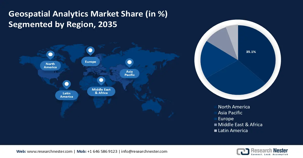
North America industry is anticipated to account for largest revenue share of 35% by 2035 The market growth in the region is expected on account of rapid urbanization and the development of smart cities. As an intriguing phenomenon in contemporary urban development, smart city efforts seem to be thriving which relies on geospatial analytics for efficient resource management. According to the United Nations, with 82% of its people living in cities, Northern America is the most urbanized region in the world.
The market in Canada has been steadily growing, driven by advancements in technology and increasing applications across various sectors. Canadian companies specializing in geospatial analytics, along with global players, are actively expanding their presence on the market through partnerships, acquisitions, and technological innovations. For instance, in 2022 Carl Data Solutions Inc., a leader in predictive analytics that uses artificial intelligence and machine learning for compliance-driven environmental monitoring as a service ("EMaaS") and smart city applications, has formed a strategic partnership with Montreal-based K2 Geospatial ("K2").
GIS technology is frequently utilized by the United States federal government's independent National Aeronautics and Space Administration (NASA) to improve user experiences by enabling strong capabilities for managing, viewing, analyzing, serving, and disseminating crucial data and insights.
APAC Market Insights
The Asia Pacific region will also register tremendous revenue share in the geospatial analytics market owing to the increasing government initiative for the protection of the environment. The preservation of natural heritage in the region has faced numerous difficulties lately, which is likely to boost market demand since the governments have implemented several initiatives to promote green economic restructuring, livelihoods, and economic growth.
Tourism in China requires the assistance of GIS (geographic information system) technology for landscape planning including mapping, spatial analysis, communications with tourists, and visualization of the landscape.
Japan is among the nation’s most vulnerable to natural disasters such as worldwide, which necessitates planning for natural disasters as a crucial aspect of urban development. The country has made significant investments in cutting-edge methods of natural disaster mitigation, which helps individuals comprehend natural disasters better and increases awareness of potential natural disasters including earthquakes.
The market in South Korea is expected to grow at a high rate, as it is being utilized by enterprises, governments, and researchers in a wide range of applications. The Korean Land and Housing Corporation, as well as the Ministry of Land Infrastructure and Transport, have made major investments in geospatial technology and policies.